Water sleep II Akaike river under Xizang Road
Fun Facts of Movie
Subtitles in Spanish, English, Japanese and Traditional Chinese Music by Yun Fang Tseng Commissioned by Flaneur Magazine
Maps are controlled by nation-states: who creates them, what they look like, how they are read and how they are shared. water sleep II: Akaike river under Xizang Road (2019) is a film essay in which the artist guides us in the search for a lost river through historical maps.
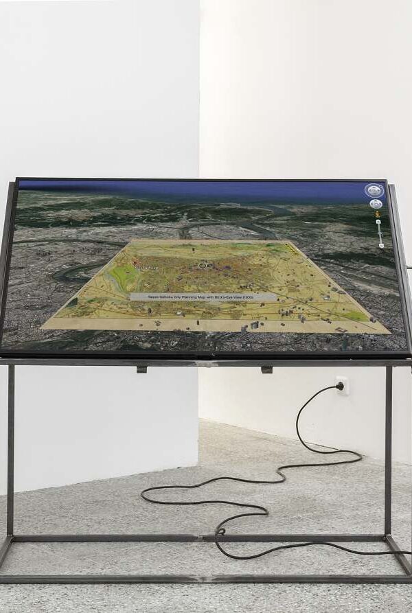
The Taipei/Taihoku City Planning Map with Bird’s-eye View (1935) and the Taihoku Aerial Map, produced by the US Army’s 14th Air Force (1944), reflect Taiwan’s colonial history. The process offers an alternative reading of these documents through a decolonial approach to cartography, shifting attention towards the evidence contained within seemingly objective representations of the landscape.
water sleep II: Akaike river under Xizang Road takes as its starting point the Akaike River, a tributary of the Xindian River, approximately 15 metres deep and 25 metres wide. Between 1976 and 1979, the municipal government covered over the Akaike — which had been dredged after the war and converted into Drainage Channel No. 3 — to widen Xizang Road.
Drawing on two historical maps of Taipei — the Taipei/Taihoku City Planning Map (1935), by Japanese painter Ōkubo Shirō, and the Taihoku Aerial Map (1944), assembled from two aerial photographs taken by a photographic reconnaissance squadron of the US 14th Air Force — the artist reverses the conventional reading of aerial imagery and cartographic technologies. In doing so, she reveals the ideologies and biases concealed beneath the apparent technical neutrality of the image.
These two maps represent different moments in Taiwan’s colonial history. By tracing the presence of the Akaike River in historical cartography, the work invites us to engage in a decolonial reading of maps, directing our attention towards the visual evidence through which the landscape can be reconstructed. Now concealed beneath the asphalt, the Akaike River also bears witness to the history of Taipei’s urbanisation.
Excerpt from the essay “Riverine Ecologies”, in: Maja and Reuben Fowkes, eds., Art and Climate Change, London: Thames & Hudson, 2022, pp. 80–89.
The relationship between the suppression of waterways within the urban landscape and colonial cartography is explored in water sleep II: Akaike river under Xizang Road (2019), a film essay by Berlin-based Taiwanese artist Su Yu-Hsin.
As the camera moves across a bird’s-eye-view map of Taipei drawn in 1935, during the period of Japanese colonial rule, it exposes the distortions of colonial cartography, which privileged Japanese settlements over Chinese villages and visually reduced the distance between Taiwan and the distant mountains of imperial Japan.
A second map, produced in 1944 by the US military using aerial photography to identify bombing targets, further reveals, through its strategic selection of details, the lack of neutrality in cartographic representations.
What these colonial maps do reveal, however, is the presence of the Akaike River, which was first reduced by the authorities from a named river to Drainage Channel No. 2, before being covered with concrete in the late 1970s to “improve the cityscape and transportation”. Yet the river has disappeared from contemporary digital visualisations of the city.
The artist uses this historical information to reconstruct its course through Google Earth, following its path along Xizang Road and inviting viewers to imagine themselves travelling “on a motorcycle riding above an invisible river under the asphalt”. At the end of the film, emerging from a pumping station towards the estuary, the river meets the horizon, affirming the continuity of its fluvial existence.
Cast & Crew
Artist